Feb 1, 2012
Morning hike at Horton Plains
For most part of our ascend by van to Horton Plains from Nuwara Eliya, we were shrouded in blankets of fog and visibility pretty much stayed within the range of a few meters ahead of us. Light drizzle also accompanied us on this early morning as Nilan drove up small and windy road of… well, I don’t really know, since I could hardly see much. Instinctively, I believe, if we ever slipped up, we would be rolling down the side of a pretty high hill.
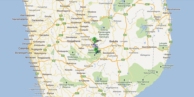
However the task was not at all daunting for Nilan. The distance we were to cover was just over 30km but it’d take approximately 2 hours. He was busy as ever chatting on his mobile phone (hands free, in an unconventional manner – don’t ask) while Claire and I silently wished he would not be too distracted when he shouldn’t be. Honestly, we had no idea who he’d be talking to at six in the morning. If anyone ring me at that time, unless it’s an emergency, I’d hang up right away. Secretly though, Claire and I were impressed at the strength of mobile phone reception in this country. Even high up at a remote national park was no barrier to mobile telecommunication here!
We finally entered the Horton Plains National Park via Pattipola and proceeded to obtain our tickets (US$20 per person + additional vehicle charge). Not only were we battling rain at this point, the wind was also strong, prompting us to wonder if we’d made the right call to hike that morning. Luckily we did wrap up well so at least we were not cold, even if we looked like something the cat dragged in. Our raincoats/ windbreakers also came in handy to shield us from some of the elements.
After another short drive, we finally came to the starting point of our walking trail. And perhaps luck was on our side afterall – the rain stopped, the wind died down and the sun started to peek out among the clouds. Consulting the route map, it appeared we would be doing a rather circular trail, with three main points of interest to look out for – Mini World’s End, World’s End and Baker’s Fall. We would cover approximately 10km in distance and it must be noted that this is the only national park in Sri Lanka in which one can walk freely (following the designated path, mind) without a guide.
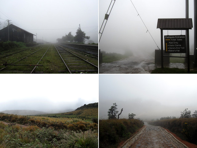
After consulting a guide map near the start of the trail, we turned left and took off in the direction of Mini World’s End. Our thinking behind this decision – it’d be better to view the Mini World’s End first ahead of World’s End. Apart from the paved few hundred metres from the starting point, the remainder of the trail was just good ol’ trampled paths of red-yellow soil peppered with rocks and pebbles, lined with low lying bushes and framed by taller trees and bamboos in occasional stretches. Soon enough, we found ourselves peeking at the Mini World’s End.
Ok, you must be wondering what’s the deal with the World’s End, mini or not. World’s End basically refer to the feature of this plateau where the edge fell in a straight drop manner to the valley. Not gentle slopes there. It was as if the earth just collapsed in a vertical column. At Mini World’s End (or Little World’s End or Lesser World’s End), the drop is not quite as pronounced, measuring nearly 300m, but at World’s End, just under 900m separates the standing edge and the solid ground below. That’s higher than the height of Burj Khalifa, the tallest building in the world. It’s a very long way down this impressive precipice.
The views from Mini World’s End and World’s End were nearly identical when you cast your eyes in the horizon. They were absolutely gorgeous. Sun was shining overhead, the sky blue as it could be, and somehow the misty cloud covers that came and went made it all seem ever more romantic. This phenomenon of low cloud cover is common enough to earn national park the name of cloud forest. We had a little snack pause at World’s End and took our time basking in nature’s beauty. Over on one side, Nilan was back talking on his phone (yes, mobile phone coverage even here!) when not moonlighting as our photographer. Since it was also getting progressively warmer, we began to shed a layer or two of our clothes.
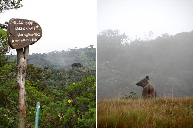
We didn’t encounter too many people (nor wildlife for that matter – except for a sambar deer and some birds) along our walk. I supposed, given the nature of the circular trail, it would be unlikely to bump into other people unless (a) they stopped en route and we caught up with them, or (b) they started in the other direction. Most of the other walkers that we ran into were groups of locals or visitors from the region, and only a Caucasian couple at World’s End. I was assuming Horton Plains may not had been as interesting as Adam’s Peak and so the other foreign tourists had gone to Adam’s Peak to chase the Buddha’s footstep instead.
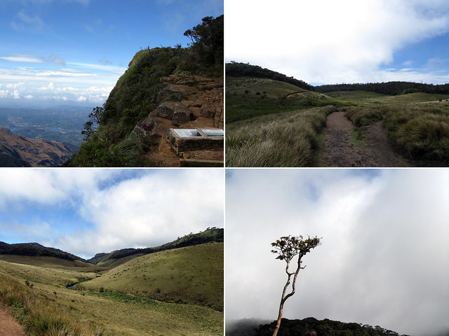
While Horton Plains was very much a plateau, the scenery unfurling before us could only be described as rolling landscapes. Little waves and mounds that contoured up and down, up and down, before sweeping outward into open space. It felt of freedom in the great outdoors. Anyone who knows me well know that I’m not particularly outdoors-y kind of person, but I thoroughly enjoy every minute I was out there, taking small skippy steps along the path. Skippety skippety skip! (A little à la Dora the Explorer.)
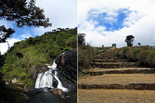
The tougher challenge of the trail was in accessing the waterfall called Baker’s Fall. Hidden tucked away from the main trail, one has to descend a series of natural stairs, some of which the steps were knee-high, for a good couple of hundred metres. Going down wasn’t too bad, but coming back up, now that was a stairmasters work-out if you will. I was sure my gluts were working overtime (excellent – I needed to shed the calories from all the rice and curry I’ve been pigging out on) and if that didn’t give me a perkier bottom, I don’t know what would. ;)
Rounding up the last part of our trail, we came to pass small lakes and rivers, and there were people bathing in it too! A group of topless young men wolf-whistled us and out of good sense, we decided to take a slight detour away from them so not to encourage the behaviour. Plus, we didn’t want to be subject to any overexposure we did not set out to see that morning, if you catch my drift…
The final sloping trail (uphill of course, just not to make things too easy) seemed to stretch indeterminately in front of us. We had, overall, made good time with our walk, completing the trail in just over 2 hours. As we approached the end of the loop, we saw more groups arriving, eager to start their walk. I wasn’t entirely sure if they would enjoy walking under hot sun though, as the temperature has been climbing steadily as time passed and I was desperate to change out of my gear into a maxi dress to cool down.

There is a visitor centre cum museum which one can take a look around, and a small hut next to the parking lot that sells snacks and drinks to fresh and weary hikers alike. I decided to try some local snacks (sorry, didn’t quite catch their names) that came with lovely and spicy dipping sauce. It was a pity though that the hut was not equipped with proper food preparation set up (so the snacks were brought up here) and so I had to eat them cold. I suspect they would have tasted much better warm. (At the same time, I prayed my gluttony would not lead me to stomach ache or food poisoning…)
One last thought of the day – the tuk-tuks. It was incredible to see them up at Horton Plains, given the amount of work it’d required from the vehicle to make the climb up the long and windy road. If a van felt the strain from the drive up, imagine how it could be on a tuk-tuk!
Anyway, don’t forget to check the Flickr photoset for the rest of the photos from this walk. I truly enjoyed it and sitting at my desk in a crowded city right now, what I would give to be out there again for a few hours.
All posts in this series:
Sri Lanka: Ceylonese Tales
Sri Lanka: Trekking Sigiriya | Flickr Photoset
Sri Lanka: Cave temples of Dambulla | Flickr Photoset
Sri Lanka: Cultural evening in Kandy | Flickr Photoset
Sri Lanka: Pinnawala Elephant Sanctuary | Flickr Photoset
Sri Lanka: We sort of saw Nuwara Eliya… | Flickr Photoset
Sri Lanka: Morning hike at Horton Plains | Flickr Photoset
Sri Lanka: A room with a view in Ella | Flickr Photoset
Sri Lanka: Tissa, Yala and safari | Flickr Photoset
Sri Lanka: The southern coast | Flickr Photoset
Sri Lanka: The old fort of Galle | Flickr Photoset
Sri Lanka: Roadtrip ended in Colombo | Flickr Photoset


nice photos and the weather indeed changed in a span of few hours….didnt know there is such a place in sri lanka…looks like a temperate valley in some of the shots ;)
sri lanka is quite diversed as a country goes, from the lowlands and beaches with waves that crash in mightily to the highlands and cooler regions, not unlike peninsular malaysia really ;)
How early in the morning did you start your hike to avoid the hot sun and too many other tourists?
We arrived there just after 7am.