A short Tram 15 ride away to the southwest from Lisbon, Belém beckons. Two main sights draw the visitors in – the Jerónimos Monastery and the Tower of Belém. Some may say there’s a third attraction – the Pastéis de Belém where queue stretches beyond its front door with a length that rivals the monastery and the tower. Arriving late in the afternoon from Tomar, we skipped the pastry and visited the heritage sites. (There are quite a few museums around too but they don’t have quite the pull like these three.)
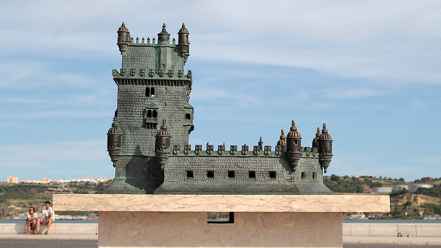
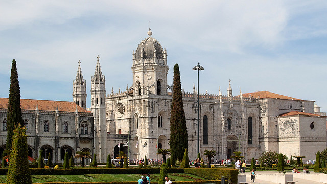
We visited on the first Sunday of the month, so both Tower of Belém and Jerónimos Monastery were free to enter. That being on the weekend, there were quite a lot of people visiting too, but without the delays caused by ticket purchase, we did get in reasonably quickly. A 10-minutes walk separate the two if you go along the seafront, passing the Monument to the Discoveries en route, with a view of the reduced-size Golden Gate Bridge (actually Ponte 25 de Abril) and Christ the Redeemer (known as Cristo Rei) in the horizon.
Continue reading »
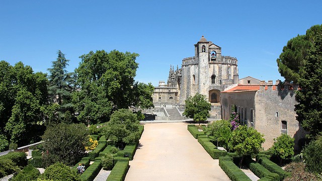
Strategically placed on a hill and overlooking the town while remaining near to River Nabão, the Castelo de Tomar is an imposing figure, protective over the Convento de Cristo, as both constructed were under the watchful eyes of Gualdim Pais and set to be the seat of the Knights Templar in Portugal. Today a designated UNESCO World Heritage Site, the air of mystery is abound within the walls of the castle and the convent, alongside interesting Templar and Manueline architecture – with hints of Moorish and Gothic influence – to feast our eyes upon.
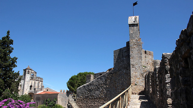
The castle, expectedly, forms the defence system which in the past, secured the Christian Kingdom which was advancing from the north against the Moors which reigned supreme in the south. The outer defensive wall has sloped lower half and round towers to make it more difficult to attack. When the citadel within reached its capacity for residency, dwellings outside the walls were built, which gave rise to Tomar. As you can imagine, it’s now a relatively easy walk between the town and the castle.
Continue reading »
Every four years, the town of Tomar honours the Holy Spirit. Every four years, for about six months before the Festa dos Tabuleiros (aka Festival of the Trays), households were busy making flowers and leaves from crêpe paper. Every four years, expectant tray bearers put their names onto a list and hope to be a chosen ones. Every four years, the streets are lavishly decorated and there is a certain zing in the air.
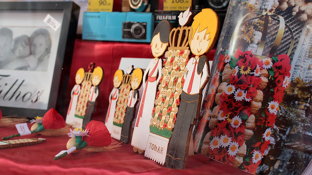
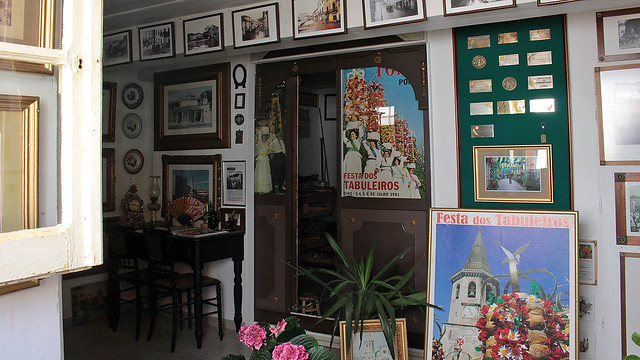
During each festival, parades are organised where the locals are paired up, age-appropriately, and the girls/ladies carry the tabuleiros on their heads. Typically, for adults, the tabuleiros are approximately the height of the bearer! Built using stacked breads decorated with paper flowers, leaves and oats, often topped with crown and dove or crown with holy cross, the tabuleiros are not very heavy per se but there are certainly some training needed to balance the trays against the elements. (We spotted many who practiced walking with their trays around town, usually in the evening when it was cooler.)
Continue reading »
The legend of Knights Templar, rebaptised Order of Christ in Portugal, is well and alive in Tomar. Founded in the 12th century by the 4th Grand Master of the Knights Templar, Gualdim Pais, it is today a town of pilgrimage – it lies on the St James’ way from Portugal – which honours their tradition by hosting the annual Festa Templária, the Knights Templar Festival, where hundreds of local participate and dressed as Knights Templar to parade through the streets.
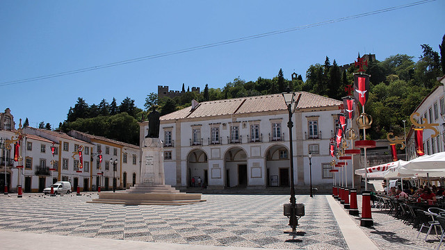
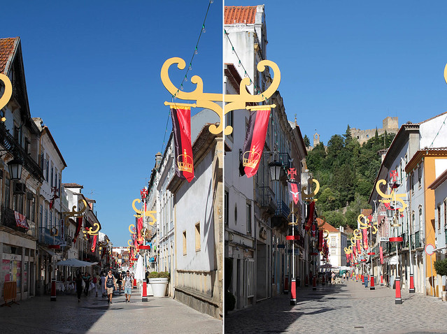
The heart of it all is the Convento de Cristo (more on this in an upcoming post), perched above the town, a symbol of the glorious past when the Knights Templar enjoyed great privileges and revered by many. The distinctive cross that came to represent them can be found all over Tomar, and there’s even rumour of hidden treasures of the Order but like any good ol’ legend, who knows its veracity? After Sintra, Tomar may on the surface seems less spectacular but there are enough mysteries to keep a healthy imagination going. ;)
Continue reading »
I debated if I should write a single (long) post of the palaces we visited in Sintra, or break them down individually. Laziness won. ;)
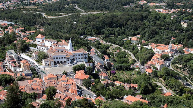
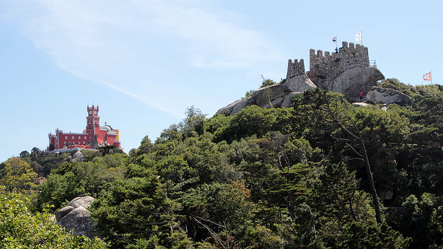
The one really tricky thing task is whittling down the number of photos on this entry, so scroll down for the links to the Flickr photosets if you really want to see them all. Be glad I selected only some 30 photos on average per palace, from the few hundreds I took for each! :p
Continue reading »
We took one look at Sintra and F turned to me, “Are you sure we won’t add another night here and reduce one in Tomar?”. In hindsight, yes, we should have done that. Don’t get me wrong – Tomar is a lovely historical town (more on this when I get round to writing about it) but there are just so much more to do and to visit in Sintra – in addition to being drop dead gorgeous – by comparison that we could benefit from a longer visit here. The 48-hours we allocated flew by far too quickly so we were also rather baffled to see so many day-trippers from Lisbon shuttling in and out quickly in a few hours.
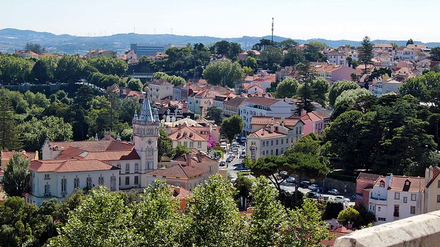
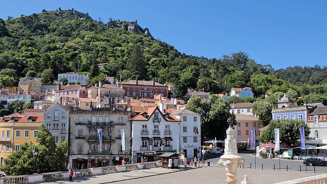
Travellers from Lisbon, us included, can easily get to Sintra in about 45 minutes from Lisboa-Rossio train station, if one managed to find the train station in the first place… It is not the best sign-posted train station we’ve ever came across and from the exterior, it could easily passed for a city hall or something to that effect. Gorgeous building, terrible signage. In any case, armed with our topped-up Viva Viagem card, we beeped our way across the barrier and hopped on the next train out. There are trains every 10-30 minutes, depending on the time of the day, and one-way travel costs €2.15 per person.
Continue reading »
At the heart of Faial lies the Caldeira, seated atop Cabeço Gordo (“fat mountain”), which opened to a spectacular view not only within the crater but the coasts of the island too. Standing at 1,043m above sea level, this is the highest peak of Faial that on a clear day, opened panoramically towards neighbouring Pico, São Jorge and Graciosa.
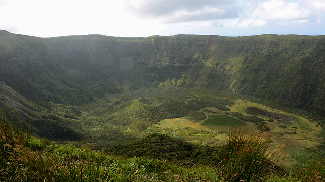
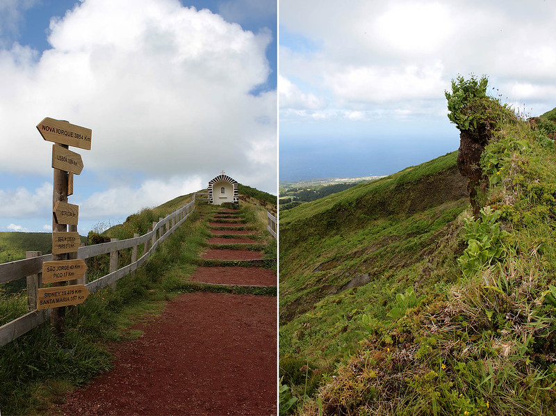
The caldera is 2km wide with a depth of 400m, and a 8km path exists for a short 2-2.5 hours hike for the keen. Clouds hovered over us as we made our way around the caldera, at time walking on narrow path with immediate drop on both side of the path (eeek!), at time on wide-enough-for-a-car path, and at time on muddy ground especially after some rain. The strong wind was my bigger concern – what if it tried to blow me away?
Continue reading »
“If you drive non-stop along the primary road, you can complete the loop in about an hour.”
Faial is not a very big island, home to about 15,000 inhabitants, a large caldera at Cabeço Gordo (more on that in a separate post), a relatively new land mass called the Capelinhos, and if the name of one of the hiking trails is anything to go by, a series of 10 volcanoes on a route of 20km (it’ll take 7 hours to hike). To us, Faial is more green from the vegetation than blue, for we didn’t see quite that much blooming hydrangeas that help earn the island its nickname of the Blue Island…
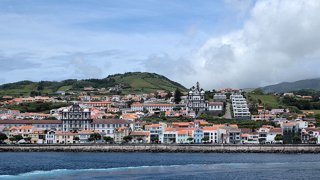
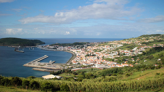
Like Pico, micro-climate is everywhere but we largely got lucky and managed to stay ahead of the rain cloud most location we went, unless it happened to be raining heavily islandwide… I managed to get a bunch of postcards written up while waiting for the sky to clear, even as we lamented the loss of time to be out exploring. Or go on a marine excursion.
Continue reading »
Just under 60 year ago, over at the Azores, the sea was rumbling. Throughout the course of the following 13 months, regular tremors were felt and active volcanic eruptions sent the residents of Faial, especially those on the western half of the island, packing and sailing for Boston after they lost their homes and agricultural lands, abandoned and buried under thick layers of ashes. To this day, the surrounding area remained largely uninhabited.
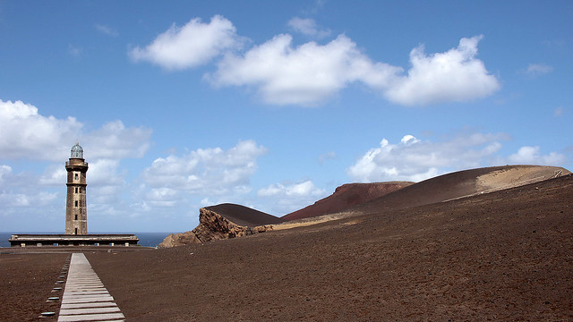
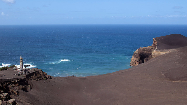
Those who stayed, or came to study the event, saw the birth of a new land mass that attached itself to the Costado da Nau Volcano, extending Faial with an area of about 2.4km² off the coast of Capelo. It was baptised Capelinhos; it is also the most western land point of the Eurasian plate. Today, what we see is a unique landscape of barren layers of submarine ashes and hardened lavas. Mother Nature sure knows how to make an entrance.
Continue reading »
How do you spot the unprepared pair of hikers at Mount Pico, the highest point on Pico Island with an altitude of 2,351m? Well, they arrived at 1pm to commence what is normally a 7-hour trek (3 hours up, 4 hours down) with 1.5L of drinking water between them, a puny sandwich each for lunch, plus a couple of cereal bars for snack. And oh, no trekking poles either. There you go, it seemed F and I were off on a great start, no? :p
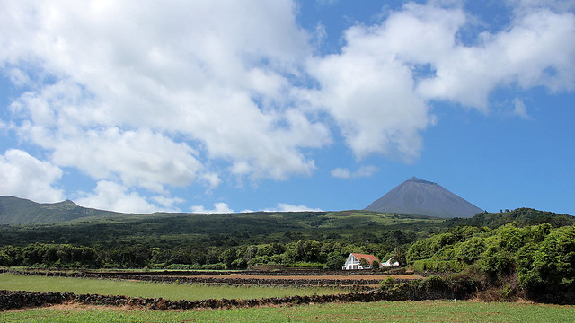
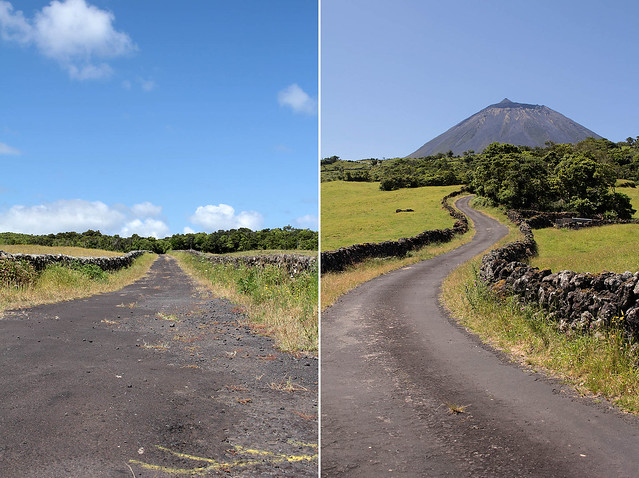
After a scenic drive from São Roque to the Casa da Montanha (i.e. House of the Mountain) that took longer than expected, but we suspect much prettier and off the beaten path compared to the route that most visitors have normally been sent along, we duly reported ourselves to the staff in charge so we can be registered, provided with a GPS tracking phone in case of emergency and rescue, and briefed on safety and relevant information. We were lucky that the day was clear and the conditions to trek, according to the staff, was the best for the dates that we were in Pico. We also had just about enough time to do a day hike and return before the day turned night. Up we go then!
Continue reading »


